
Dedicated Mount Peak hikers were rejoicing last week with the news that the popular Cal Magnussen Trail was again ready to greet visitors.
The trail, which winds up the north side of the volcanic cone, was closed following heavy rainfall on Oct 21-22. At that time, King County Parks noted “extensive damage” had been done to both the surface and base of the trail; the washout occurred in a particularly steep and narrow portion of the challenging path.
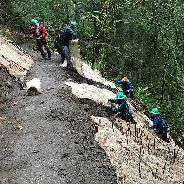
The repair project, coordinated by King County Parks with assistance from the Washington Trails Association, wrapped up and the trail was opened Dec. 4.
A Parks spokesman, via email, explained the situation this way: “After a thorough evaluation of the slide location, we determined the best approach to rebuilding a stable trail through that stretch was to use a roto hammer to cut out a large enough trail bed platform (known as a ‘tread bench’), then add mineral soil on top of that to create the trail surface.”
The repairs weren’t particularly expensive. Parks purchased the $1,200 rotary hammer tool to deal with the rock work and spent another $300 on erosion control measures. Also factored in was the annual agreement between King County Parks and the WTA; for $138,000 per year, Trails Association members provide a specified number of work days throughout the year, helping maintain 215 miles of trail in the county system.
There were 15 WTA volunteers on Mount Peak Dec. 3 and 10 on Dec. 4, getting the trail in shape.
The Magnusson Trail is the more challenging route to the top of Mount Peak, which rises approximately 800 feet above the surrounding Enumclaw Plateau.
While the north-side trail was closed, the less-challenging south side access remained open. That side, accessed by Mud Mountain Road, has a fully developed parking lot, complete with restrooms.
Mount Peak – formally called Pinnacle Peak Park by the county – takes in 375 acres with five miles of trails. Those making it to the top find outcroppings of columnar basalt, concrete footings of an old fire lookout and views of Mount Rainier and the White River valley.
