Green River Natural Area: some trails short and simple, others provide a test
Published 9:20 am Thursday, September 24, 2020


This is Week No. 8 in a series of articles about local trails, campgrounds, parks, etc. – simply about places to enjoy the outdoors without traveling too far. Ideally, this will encourage folks to get outside, get some exercise and forget that we have been cooped up for months.
The focus will be on destinations in our own back yard and all will be of the “day trip” variety. Previous weeks have featured outings like the Naches Peak Loop Trail, Mud Mountain Dam and Nolte State Park; this week we’re headed to the Green River Natural Area.
The target audience is the novice or, at least, not a seasoned veteran of the woods. Nothing here will involve summiting Mount Rainier or spending days trekking the Wonderland Trail.
If you have a suggestion for a fall hiking/camping adventure, pass it along. Just email khanson@cmg-northwest2.go-vip.net/courierherald. Offer a brief description from your personal experience.
The Green River Natural Area can provide just about anything a hiker is looking for, provided that hiker is looking to stick close to Enumclaw and not spend an entire day tramping up and down a mountain.
In other words, it’s not a tough outing. But that doesn’t diminish the natural beauty of 1,230 acres designed to protect the middle stretch of the Green River and benefit migrating salmon.
The King County-owned property is environmentally important because it takes in both the north and south sides of the river – flat and easy on the north while steep and a bit more challenging on the south side.
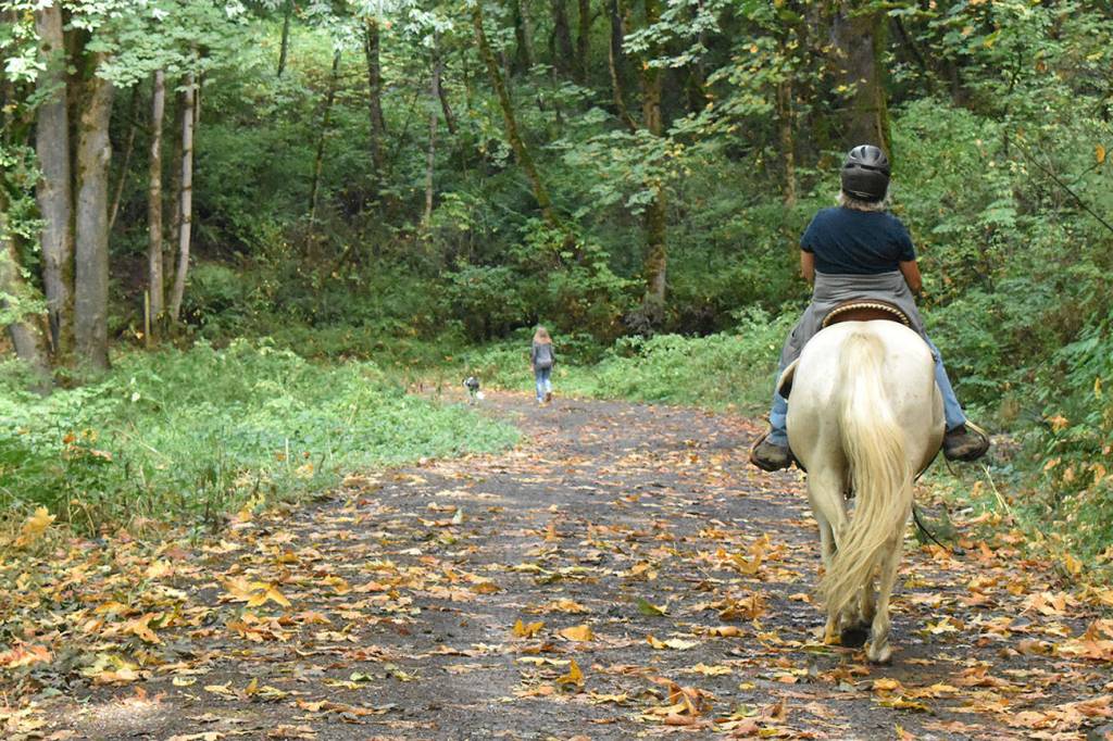
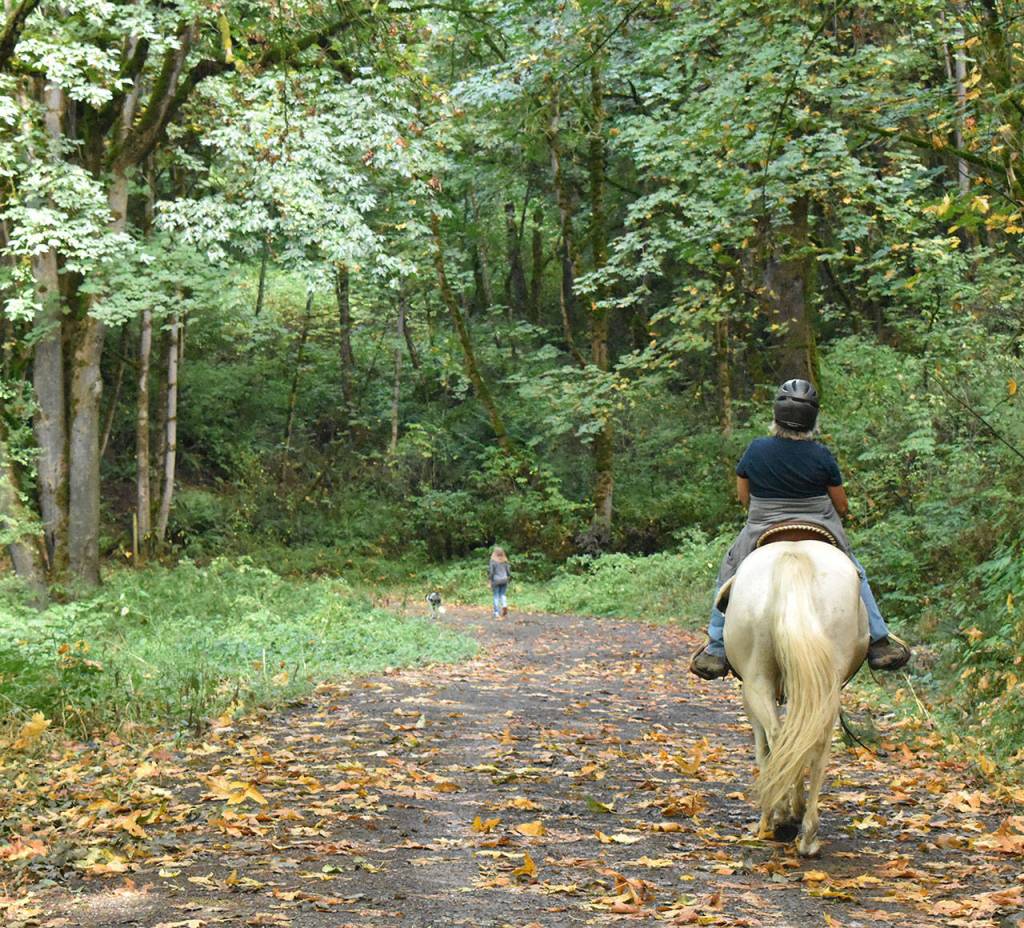
The Green River Natural Area sits between Enumclaw and Auburn and sports an interesting history. It is made up of the former Metzler, O’Grady and Green River Waterway parks (according to the County Parks and Natural Resources website) and includes more than seven miles of trails. Trail users are mostly on foot, but the south side is popular with equestrians; the north side is suited for those looking to float the river or catch a fish.
THREE ACCESS POINTS
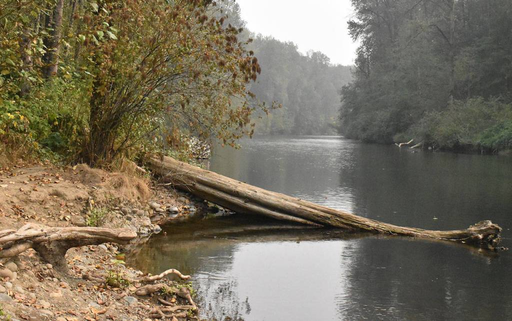
The Green River Natural Area can be visited from two points on the north side of the river. The Metzler access includes a paved parking lot (19 stalls) while the Doreen Johnson trailhead has only a wide spot for a few vehicles. Both access points are on Green Valley Road, west of Flaming Geyser State Park.
Neither of these provide a real hike, but they’re a pleasant enough walk suitable for all ages. It takes just a few minutes from trailhead to terminus at the river’s edge. At the end of the line, the Green River is wide and serene.
The O’Grady access is not really near the river, found at the dead-end of a country road (details below).
O’GRADY TRAIL OPTIONS
For those interested in more than a casual stroll, the O’Grady access is the place to be. A variety of trails offer miles of options, uphill and down.
The distinguishing characteristic is that the trailhead is on the Plateau and the Natural Area extends to river level. That means, eventually, there will be hills involved.
From the O’Grady trailhead (driving directions to follow) the dominant feature is a 1.2-mile access road that leads to flat land. Trails branch off on either side. Heading downhill, the Stevensonville Trail loops to the left and the Hops Craze Trail goes off to the right; both eventually return to the access road. Other prominent features are the Potter Trail at the bottom of the access road that heads up and around before reaching the Green River and the Three Bridges Trail that joins other trails and eventually connects to the river, downstream from the access road.
Despite parking in a rural neighborhood, the O’Grady entrance quickly loses the sounds of civilization and narrow trails provide a legitimate hiking experience. Again, there’s nothing too challenging.
KNOW BEFORE YOU GO
• Getting to O’Grady: First, be aware you’ll travel some rural roads, so pay attention and yield to our ag friends. Head north out of Enumclaw, using either state Route 169 or 244th Avenue Southeast, and turn left (west) at Southeast 400th Street. Turn right onto 212th Avenue Southeast and follow the road when it bends to the left and becomes Southeast 384th. Travel about 1.5 miles (if you pass Wabash Church you’ve gone too far) to 188th Avenue Southeast and turn right; the road dead-ends in less than a mile at your destination.
• Dogs: our furry friends are welcome as long as they’re kept on a leash.
• Horses: This area is popular with equestrians and there are plenty of reminders – so watch your step.
• Pass: It’s all free, no special pass or permit is required.