Hiking trails are scattered throughout the Plateau region, offering a chance for outdoor recreation. Some are flat and paved, others rugged and challenging.
Bottom line, there’s a trail to suit most everyone.
Here’s a look at three Plateau trails that aren’t difficult to get to.
OLD MINE TRAIL
The Old Mine Trail, which directly branches off the former Carbon River Road, is best described as “short but steep.”
It’s a pleasant diversion from main trail (former road) which is flat and not much of a challenge. After numerous washouts due to storms, it was decided in 2006 to convert the road to a trail.
Taking the Old Mine Trail option, hikers will experience an elevation gain of about 350 feet, thanks to steps and switchbacks.
The Old Mine Trail – as the name suggests – takes visitors above the Carbon River. Exiting the main trail, it’s about one-third of a mile to a gaping hole in the hillside that is shrouded by ferns and shaded by towering trees. There’s no added danger, as the mineshaft is gated to prohibit entrance.
It’s a link to the area’s mining history and leaves visitors wondering how intrepid miners pushed and pulled supplies up and down the steep slope. A short stretch of railroad track shows where rail cars made their way up and down the hillside. (For the record, Washington Mining and Milling never did strike it rich, most likely searching for a copper strike.)
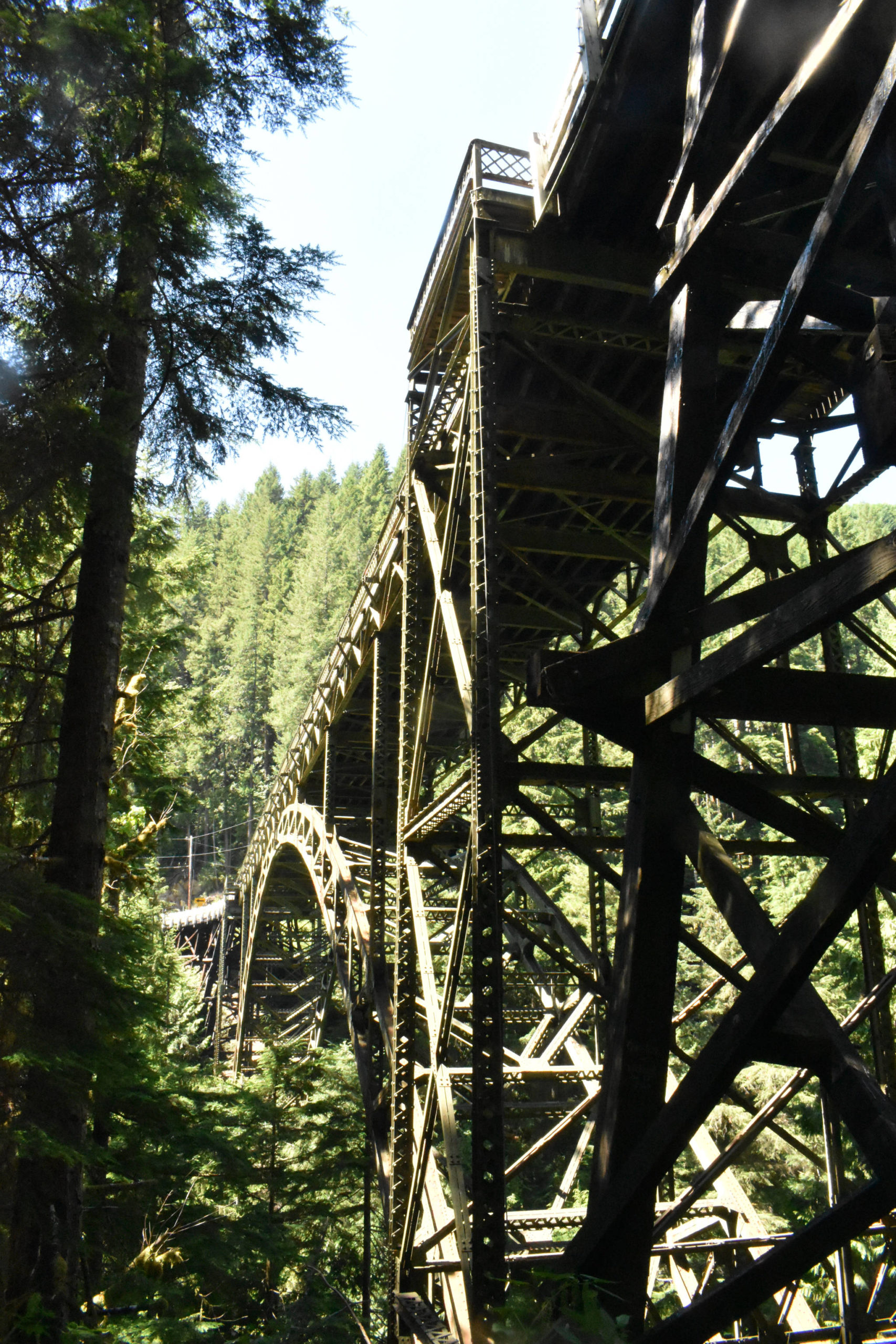
To get there, head through Buckley, Wilkeson and Carbonado and cross the wonderful, one-lane Fairfax Bridge, all on state Route 165. Veer left onto the paved Carbon River Road and travel just shy of eight miles to the trailhead.
This hike is in Mount Rainier National Park, meaning a park pass is required.
HIKING TO GHOST TOWNS
The higher elevations south of Buckley were once home to a series of small-but-booming towns filled with coal miners and their families. Among the more popular destinations – from a hiking perspective – are the historic, abandoned communities of Melmont and Fairfax.
The Fairfax expedition will take hikers on a round-trip of about 2.3 miles, without a great deal of elevation gain. Visitors should be aware than some trails are difficult to make out and can often be muddy.
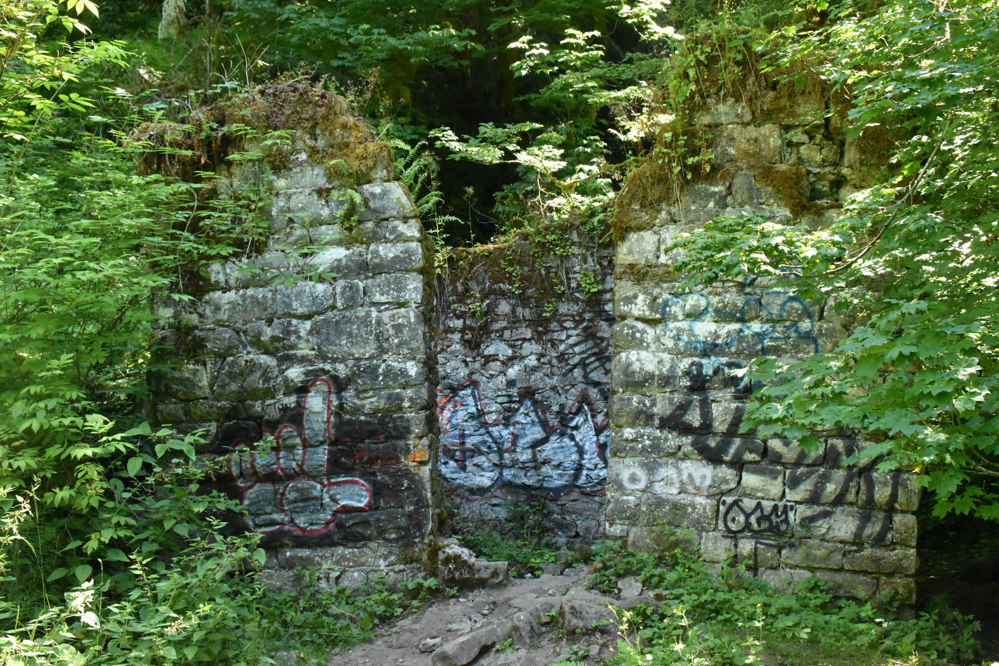
Upon arriving at the old town site, guests will notice the foundation of a swimming pool, a sure sign of the community’s one-time success. Short pillars can be found nearby, once part of the Fairfax school. Other structural remains are tied to the town’s coal-mining past.
Everything dates to the early 1890s, a time when railroad lines were constructed past Carbonado. The population grew to about 500 and the town boasted a lumber mill and post office, among other amenities. By the 1940s, coal demand dropped in favor of gasoline and oil. The town dried up and, eventually, fires and floods wiped away most signs of civilization.
Getting to the Fairfax site means traveling SR 165 through Wilkeson and Carbonado and over the spectacular Fairfax bridge (it’s a one-way affair so be patient and wait until it’s your turn). About a half-mile past the bridge, turn left onto Carbon River Road; go about another half-mile and watch for the trailhead on the left. Parking is limited and there are no facilities.
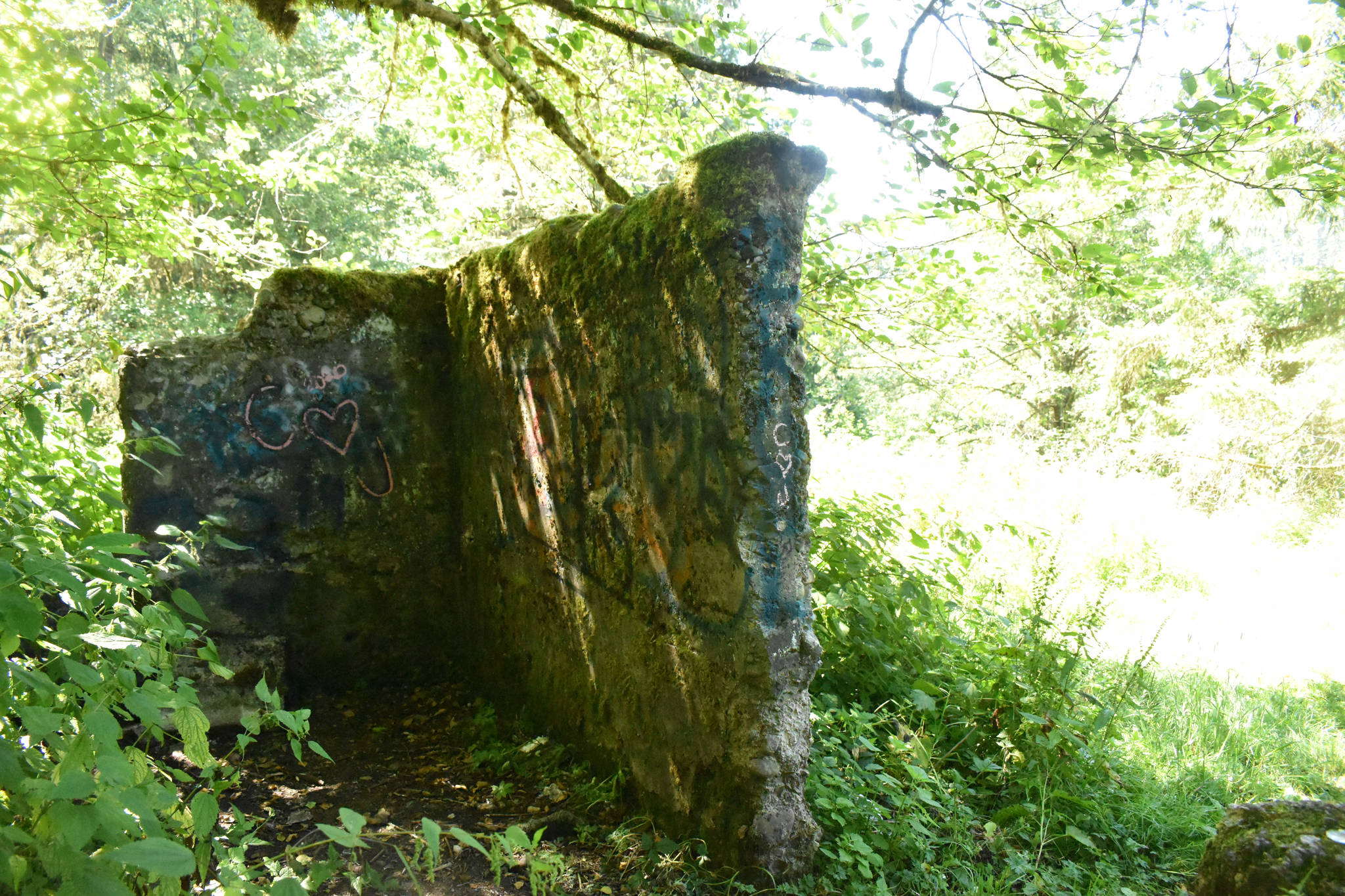
Melmont wasn’t quite the booming burg as neighboring Fairfax, but there were homes, a school and more. The foundation of the school is still evident, along with a dynamite shed used by the mining operation.
The simplest way to get there is to park in the first roadside pull-out area. There’s room for perhaps 10 vehicles and, last Sunday, perhaps twice that many lined the road. There’s a sign identifying the future home of the Foothills Trail and getting on at this point (look for a metal gate) adds a bit of distance to the outing.
More intrepid visitors venture to the Fairfax Bridge where metal cables, complete with handholds, allow for a descent to the trail. Step over a guardrail to begin the downward.
There are a few points of interest, particularly for those with an affinity for the region’s coal mining past. Easily seen are a dynamite shed, a stone wall that served as a bridge abutment and walls that helped for the Melmont school building. It’s easy to miss the school site; at a point where the trail clearly splits, take the uphill path to the left.
Adding to the natural beauty of the hike is a branch that slopes dramatically downhill to a meadow and, eventually, the Carbon River.
Reviews of both these hikes warn about muddy conditions. Both those who live in the Pacific Northwest should know to wear a decent pair of hiking boots when venturing onto forest trails. Early this week, the Melmont trail had a few muddy spots, but nothing impassible.
No pass is required to hike either the Fairfax or Melmont trails.