
Editor’s note: We will spend time this summer focusing on the great outdoors: namely, some of the noteworthy campgrounds and trails found in the Evergreen State. Most of the campgrounds will be within a reasonable driving distance from the Plateau and the same goes for trails. This series will extend into August and, hopefully, provide encouragement to get on the road and enjoy life outside – whether pitching a tent or “glamping” in a luxurious motor home, whether walking a paved pathway or mountain trail.
This series begins today with a look at Dosewallips State Park, sitting along Hood Canal.
All campgrounds and trails were visited recently by the author, his wife and two dogs. They aren’t exactly “roughing it” these days, having long ago abandoned a tent for a travel trailer.
When spending time at Dosewallips State Park, one of the highlights is a visit by neighbors that randomly wander the grounds. The resident herd of Roosevelt elk seemingly are not bothered by the two-legged, exhaust-spewing intruders who seek to share their space.
Visitors are told to stay at least 100 feet away from canadensis roosevelti, which can stretch 10 feet from tip to tail and can easily top 1,000 pounds (the bulls, that is). Of course, it’s hard to maintain a respectable distance when the elk graze to within a few steps of your campsite. Such is the case at Dosewallips.
Park guests cannot count on seeing elk, which tend to wander. They are frequently on the grounds but are generally aloof, sometimes leaving for greener pastures. But, according to a friendly camp host, they’re never far away.
But enough about elk.
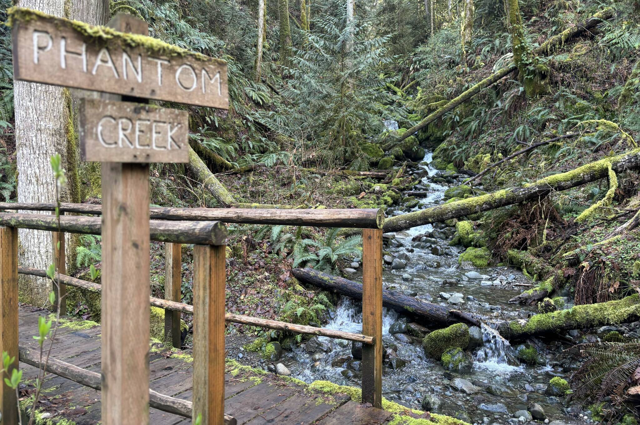
Dosewallips State Park, a spacious spot of more than 1,000 acres, is a worthy destination due to the natural topography of the land. Head out one end of the camping area and a series of up-and-down trails takes hikers through a forest and, a couple of times, across Phantom Creek.
Heading the opposite way a wide, well-worn path follows and allows easy access to the impressive Dosewallips River.
Highlighting the park’s land-to-sea landscape is the easy access to Hood Canal. A bridge over Highway 101 takes walkers up and over the river, where it’s a short jaunt to a not-too-rocky saltwater beach. The area is littered with oyster shells, emphasizing the area’s prominence in the regional shellfishing world.
The stretch of Hood Canal is home to not only oysters, but crabs and a variety of clams.
Camping information
Dosewallips State Park accommodates recreational vehicles up to 40 feet in length (some pull-through sites, some back-in) with plenty of full-hookup spots along with some providing water and electricity. There are also tent sites and cabins.
During the winter season (November 15 through March 15) a limited number of sites have water available.
Other items of interest: well-behaved dogs are allowed as long as they’re not running loose; the river running through the grounds has a slow-moving side channel that allows for kid play; and the park is open for day use, with shelters, picnic tables and public restrooms. Like other state parks, those visiting for the day must have a Discover Pass ($10 per day or $30 for an annual pass, for now).
History of the area
The state park sits at the mouth of the Dosewallips River on Hood Canal, where tidelands dominate. Erosion of the Olympic Mountains to the west, combined with the steep gradient of the river, delivers silt, sand and gravel to the lower, flatter part of the park; the result is numerous channels flowing into Hood Canal.
The park was historically occupied by Coast Salish people. Local tribes ceded ownership of the area to the federal government in 1855 as part of the Treaty of Point No Point. Eventually, much of the land in today’s state park was turned over to private ownership and used for timber harvest and shellfish production.
From private to public
The Washington State Parks and Recreation Commission, recognizing the recreational potential of the area, first bought property to create Dosewallips State Park in 1958. Day-use and camping facilities were created and the new park was officially named on November 14, 1960.
In the early 2000s, government and private, nonprofit enterprise began the Dosewallips Estuary Restoration Project. Completed in 2022, the project aims to restore natural systems and improve fish habitat for threatened summer chum and Chinook salmon.
Getting there
Sitting on the western side of Hood Canal and the eastern edge of the Olympic Peninsula, Dosewallips State Park can be reached from the north or south via the regional gem that is Highway 101. The park is about 60 miles north of Olympia and 59 miles from Port Angeles with Port Townsend serving as a midway stopping point (slightly out of the way and some added miles, but worth it).
The park is officially found in Brinnon, an unincorporated community of about 900 permanent residents (2020 census) that was established in 1860.

Dosewallips State Park waterfall. Photo by Kevin Hanson
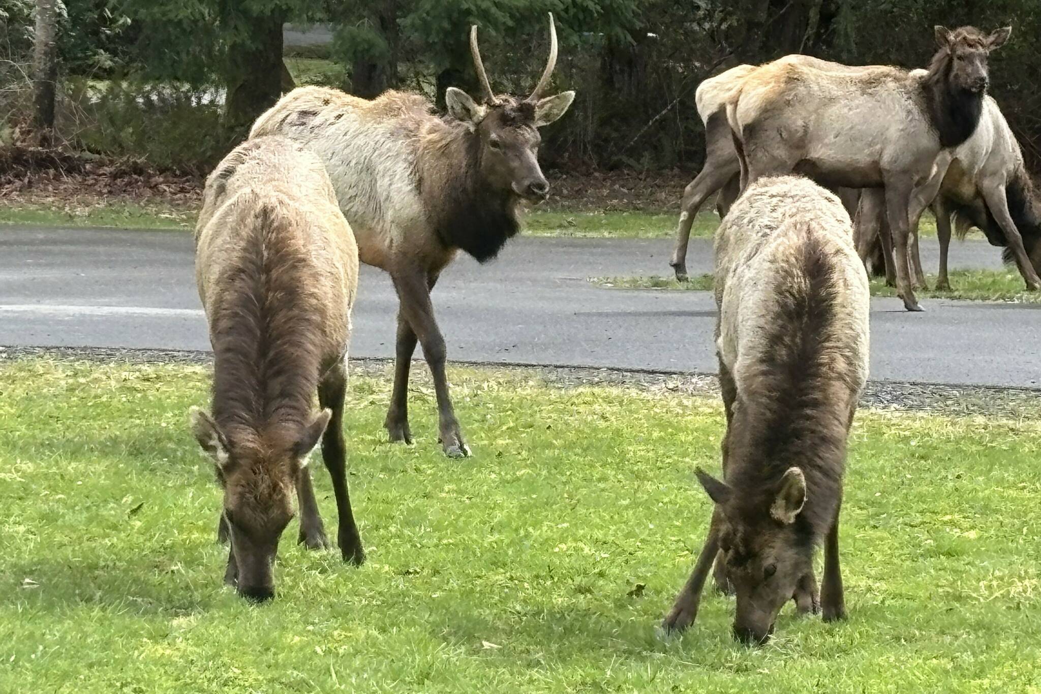
Elk at Dosewallips State Park. Photo by Kevin Hanson
