
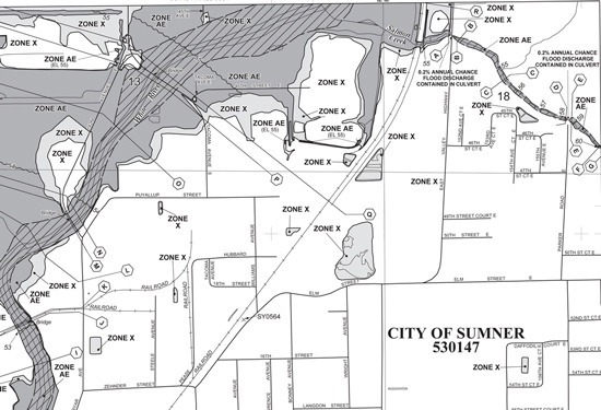
The Federal Emergency Management Agency (FEMA) is issuing new flood maps. Through these maps, FEMA identifies flood hazards, assesses flood risks and partners with states and communities to provide accurate flood hazard and risk data to guide mitigation actions.
Flood hazard mapping is the basis for the National Flood Insurance Program regulations and flood insurance requirements. The maps, once finalized, also direct the floodplain management measures that the City of Sumner must adopt in order for our citizens to remain qualified for the National Flood Insurance Program.
Starting July 15, FEMA is providing a 90-day appeal period. The City of Sumner will review the maps carefully and see if there are any facts to appeal. Individual property owners may also appeal, but only on the basis of factual, scientific information. If your property is within the City of Sumner city limits, and you believe you have an appeal, please bring your appropriate data to the City of Sumner Permit Counter in City Hall by October 1, 2015. Click here to review FEMA Criteria for Appeals (pdf).
The draft maps are available below in PDF format. The City of Sumner also has large, printed copies if you prefer to review that way.
More preliminary Pierce County flood maps are located here.
If you have questions about the proposed flood hazard determinations, please contact Dwight (Ted) Perkins, FEMA regional engineer, at 425-487-4684 or Dwight.Perkins@fema.dhs.gov.
