Foothills Trail: a popular destination now, even more planned for future
Published 9:10 am Thursday, October 1, 2020


This is Week No. 9 in a series of articles about local trails, campgrounds, parks, etc. – simply about places to enjoy the outdoors without traveling too far. Ideally, this will encourage folks to get outside, get some exercise and forget that we have been cooped up for months.
The focus will be on destinations in our own back yard and all will be of the “day trip” variety. Previous weeks have featured outings like the Naches Peak Loop Trail, Mud Mountain Dam and Nolte State Park; this week we’re headed to the popular Foothills Trail.
The target audience is the novice or, at least, not a seasoned veteran of the woods. Nothing here will involve summiting Mount Rainier or spending days trekking the Wonderland Trail. The Foothills Trail is like an old friend – always welcoming, traditionally comfortable and usually without drama.
While it’s not a hiker’s choice of destinations – there’ll be no mud on the boots – the wide ribbon of pavement provides opportunities for walkers, runners, bicyclists and even equestrians. More than two decades old, the Foothills Trail continues to evolve, with a promise of even greater things to come.
Now 21 miles long, the trail stretches, uninterrupted, between Buckley and the eastern fringe of Puyallup. Pierce County’s website notes that the trail originates in Puyallup but – for this Plateau-centric publication – the starting point will be Buckley.
DIVIDED INTO FOUR SECTIONS
It’s probably safe to assume most Foothills Trail users tackle small sections, one at a time, sticking to their favorites. Completing the entire stretch might be easy (reasonably easy?) on a bicycle, but it’s a long day for those on foot.
Here’s a quick look at four sections of trail.
Buckley to South Prairie: Close to six miles in length, this portion of trail is arguably the most diverse and most interesting. Beginning near the White River, the trail passes by Buckley’s Log Show grounds, skate park and impressive veterans’ memorial before heading into the trees south of town. Not far south of town, the trail boasts a long pinpile bridge and keeps visitors above the mud.
On an otherwise fairly flat trail, this section includes a notable decline on its way to South Prairie (another reason to begin at the Buckley end). Along the way, visitors can enjoy overhead views of South Prairie Creek from impressive bridges.
South Prairie to Orting: this is the longest section of trail, checking in at 7.6 miles. It’s an easy course, however, staying nearly flat as the trail generally follows South Prairie Creek and, then, the Carbon River.
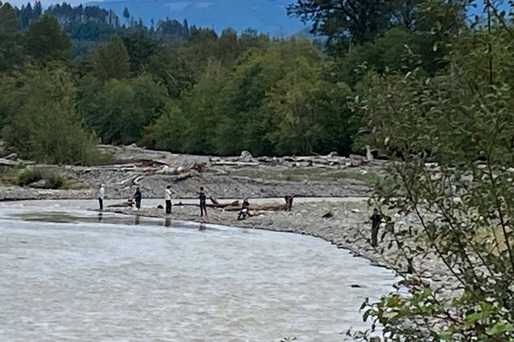
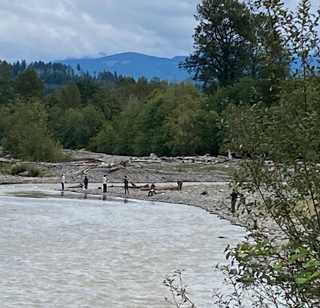
There are many stretches of trail that absolutely do not lend themselves to a peaceful stroll, due to the proximity of vehicles whizzing by on state Route 162. But that’s countered by secluded areas of serenity or, as one gets closer to Orting, great views of the Carbon River. This time of year, the shoreline is often dotted with folks hoping to land a fish.
The trail takes an urban twist as it heads into the heart of Orting.
Orting to McMillin: it’s just 2.8 miles of easy travel between these two formal trailheads. Much of the route is within Orting as the trail parallels SR 162 after it turns north. Again, vehicles zipping by on 162 are a near-constant companion.
The McMillin Trailhead is nicely done, with paved parking, interpretive signs and vintage-looking lighting. Take a moment as the informational kiosk to learn the geologic history of the area; you’ll be walking on ground created by the Electron Mudflow.
McMillin to Puyallup: this final leg is just shy of five miles, extending to the East Puyallup Trailhead and a bit beyond. The trail departs from SR 162 and cuts through some of the famous, fertile Puyallup Valley farmland. The entire stretch from Orting to Puyallup means crossing some busy roads, so watch for traffic.
SOME BRIEF TRAIL HISTORY
The Foothills Trail sits atop an abandoned railroad line, something not at all uncommon. The rails-to-trails concept has seen more than 10,000 miles of former rail line converted to trails in the U.S.
The Foothills Trail was made possible when Burlington Northern Railway abandoned the rail bed in 1982. The effort really got under way in 1984 when a Buckley physician, Dr. Doug Tait, provided the spark that led to creation of the Foothills Rails-to-Trails Coalition, a group dedicated to assisting Pierce County Parks in building the trail.
Construction begin in 1998 and, since that time, each segment of trail has been purchased or donated, with a variety of funding sources.
NEW AND FUTURE PLANS
The Foothills Trail has been completely filled in, providing the 21 miles of continuous pavement. But that doesn’t mean the effort is over – far from it.
On the King County side of the White River, the county this year extended its section of trail by more than a half-mile, adding pavement from 252nd Avenue to the historic (but largely hidden) Boise Creek Bridge. That ties into existing trail that runs into Enumclaw, eventually incorporating wide city sidewalks and stretch north to Battersby Avenue.
A jewel in the Foothills Trail crown is anticipated in 2022, when a bridge is built across the White River to connect trail segments on both sides of the county line.
KNOW BEFORE YOU GO
• What’s allowed on the Foothills Trail? It is dedicated to non-motorized use so you’ll find plenty of walkers, tons of bicyclists and skaters; there’s even a soft shoulder meant for equestrians. Dogs are allowed, provided they’re on a leash.
• Parking is not an issue. There’s adequate room at the trailheads along the route and there are other dedicated areas for vehicles. In particular, there’s a large, graveled lot along SR 162 in the historic Crocker vicinity.
• It’s a long walk, so what about restrooms? You’ll find them in Buckley, South Prairie, Orting, McMillin and Puyallup; some are of the portable variety, some with actual plumbing.