
This is Week No. 10 in a series of articles about local trails, campgrounds, parks, etc. – simply about places to enjoy the outdoors without traveling too far. Ideally, this will encourage folks to get outside, get some exercise and forget that we have been cooped up for months.
The focus will be on destinations in our own back yard and all will be of the “day trip” variety. Previous weeks have featured outings like the Naches Peak Loop Trail, Nolte State Park and the Foothills Trail; this week we’re headed to Ranger Falls.
The target audience is the novice or, at least, not a seasoned veteran of the woods. Nothing here will involve summiting Mount Rainier or spending days trekking the Wonderland Trail.
An easy stroll on a wide, flat road quickly turns into a thigh-burning uphill climb – that’s the fate awaiting those who venture to awe-inspiring Ranger Falls.
Perhaps it’s not that difficult for the ardent, outdoorsy types, but the falls present plenty of huffing and puffing for the average hiker.
The Ranger Falls hike is generally seen as a midway point on the greater trek to Green Lake. On a sunny weekday afternoon, however, the lateness of the day and shortage of physical conditioning meant the adventure terminated at the falls.
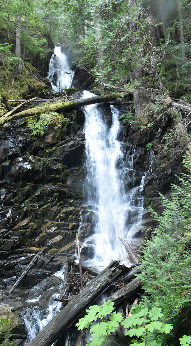
And what a sight Ranger Falls is: after treading uphill for a mile, one hears the unmistakeable waterfall roar well before the falls appear.
Fed by Ranger Creek, the pristine water begins by tumbling 44 feet, then another 55 feet before splitting in two for a 73-foot drop to the bottom.
But let’s start at the beginning. After parking and the end of the road, perhaps two miles past the ranger station, the adventure opens with an easy three miles along the former Carbon River Road. After several washouts, the road was closed to vehicles and now offers a non-strenuous entry. You’ll pass the entry to the Old Mine Trail (detailed here in the Aug. 12 edition) on a path that extends all the way to the Ipsut Creek Campground; the trek is equally popular with walkers and bicyclists.
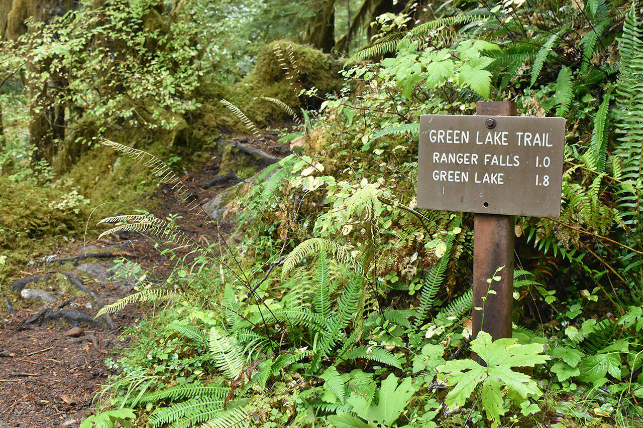
Along the Carbon River Road, you’ll get to a well-marked trailhead at one mile. That makes it four miles from where parked cars line the shoulders of the road.
It’s all uphill from there (almost all), with steps built in along the way. You’ll notice the forest makes a subtle transition with the elevation change. There are several false trails before reaching Ranger Falls, but stick to the established route – it will provide the best views.
KNOW BEFORE YOU GO
• The Ranger Falls/Green Lake Trail involves a drive through Buckley, Wilkeson and past Carbonado and across the one-lane Fairfax Bridge. Take a left where the road clearly splits (staying to the right leads to Mowich Lake). As mentioned, parking is where the road dead-ends at the Carbon River entrance.
• How about my pups? This hike is within Mount Rainier National Park and that means your four-legged friends are not allowed.
• Entry fee: A National Park Pass is required. They are available at the ranger station and can be purchased for a day or a year; the best deal is a lifetime pass for those 62 and older.
