WSDOT begins on preliminary design and environmental review of Carbon River bridge proposals
Published 10:00 am Friday, January 9, 2026
The Washington State Department of Transportation is taking its next steps in addressing the closure of the Carbon River/Fairfax bridge outside Wilkeson.
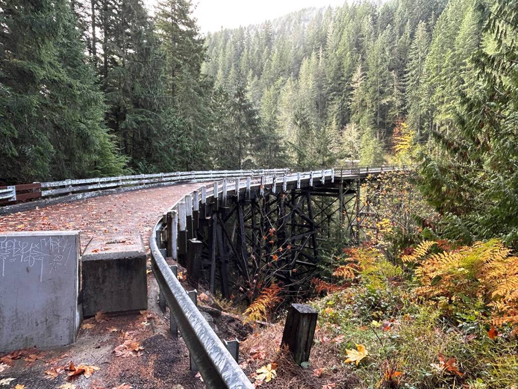
According to a Jan. 8 press release, WSDOT has published its final planning study report, and will now begin the preliminary design and environmental review of the two recommended options: replacing the bridge in the same area, or keeping the highway closed and demolishing the 104-year-old structure.
The Carbon River/Fairfax bridge was closed indefinitely on April 14, 2025, after recent bridge inspections revealed new steel deterioration; the bridge was permanently closed April 22, cutting off public access to several dozen people living on the opposite side of the bridge and Mount Rainier National Park’s Mowich Lake area.
The lack of access to the popular park is causing an economic disaster for Wilkeson, as what was once hundreds of cars driving through the city every day during the peak season has been reduced to almost nothing.
After the bridge was closed, WSDOT completed a planning study on what options were available for how to deal with the structure.
According to the department, the public’s favored option is to build a new bridge in nearly the same spot — but that would cost millions of dollars, and no funding has yet been marked for such a project.
But WSDOT has to gather much more information about the area where a bridge may be built before any such decision can be made, and has moved $7 million in preservation funding out of the 2025-2027 biennium budget for these next steps.
One of those next steps is gathering information about the soil to see where bridge foundations could be potentially built and identify the best location and alignment for a new structure.
“WSDOT is actively seeking right-of-way permits, which will allow crews to drill and collect information on soil and rock conditions in the project area,” said Olympic Region Administrator Steve Roark. “This information and analysis help determine the type, size and location for a new bridge.”
Collecting this data could take between six months and a year, the department estimates.
At the same time, WSDOT will be in conversations with the Federal Highway Administration, U.S. Fish an Wildlife, the National Marine Fisheries Service, the Department of Archaeology and Historical Preservation, various Native American tribes, and more in order to complete an environmental review under the National Environmental Policy Act (NEPA).
After the review is complete, WSDOT can take further steps toward construction, including buying property, finalizing construction permits and designs, and putting the project out to bid.
The department estimates this will take another 12 to 24 months after the NEPA process is completed.