Editor’s note: We’re spending time this summer focusing on the great outdoors: namely, some of the noteworthy campgrounds and trails found in the Evergreen State. Most of the campgrounds will be within a reasonable driving distance from the Plateau and the same goes for trails. This series will extend into August and, hopefully, provide encouragement to get on the road and enjoy life outside – whether pitching a tent or “glamping” in a luxurious motor home, whether walking a paved pathway or mountain trail.
This series began with a look at Dosewallips State Park, sitting along Hood Canal. Week two told of a local, less-used and unpaved section of the Foothills Trail, a stretch running between Wilkeson and Carbonado. Then came a return to camping with a report on Manchester State Park followed by hiking the Little Mashel Falls trail in Eatonville. Today, we return to camping with a visit to Steamboat Rock State Park.
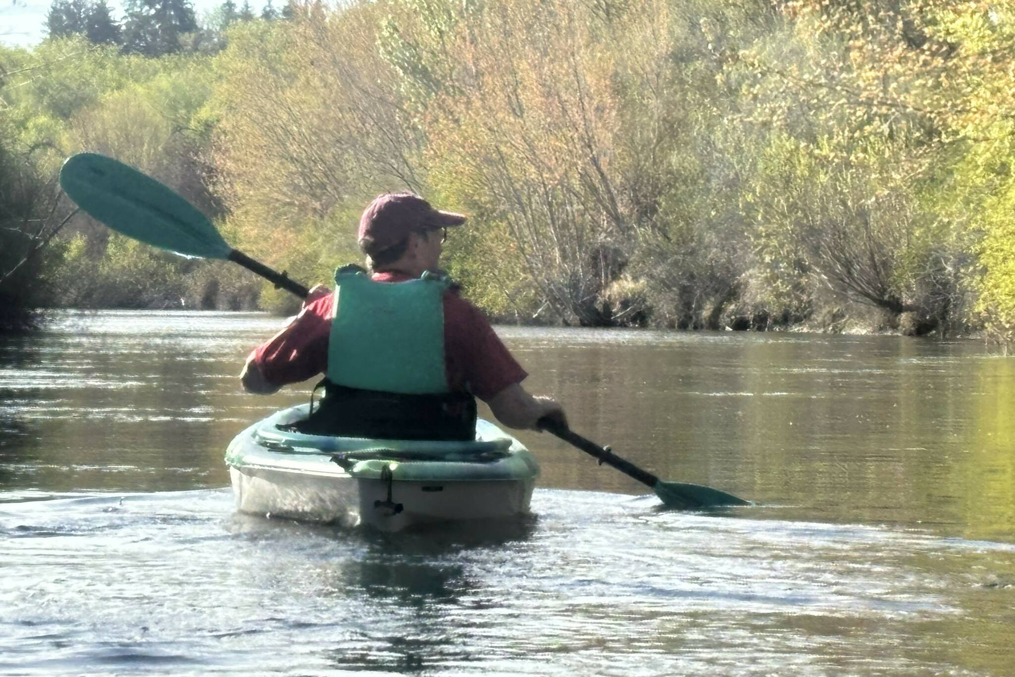
All campgrounds and trails were visited recently by the author, his wife and, usually, their two dogs. They aren’t exactly “roughing it” these days, having long ago abandoned a tent for a travel trailer.
When considering Steamboat Rock State Park a handful of numbers immediately come to mind. First, it’s a large park that takes in more than 5,000 acres; second, it offers a variety of recreational pursuits with 50,000 feet of freshwater shoreline; and, finally, it sits at roughly 1,600 feet elevation in the heart of Washington’s arid coulee country.
Yes, there’s a lot going on here and a lot to offer campers of all shapes, sizes, ages and abilities.
The high desert location may not offer the lush forests of the state’s west side, but the Central Washington climate offers visitors a different, drier world.
Let’s talk camping: Steamboat Rock State Park offers campsites ranging from primitive to full hookups with both back-in and pull-through options (maximum length is 50 feet). You’ll find cabins, spaces for tents, restrooms and showers. Located in Grant County, the grounds are open year-round, reservable from April 1 through October 31.
Like many campgrounds east of the Cascades, Steamboat Rock is short on privacy. You’ll be camping in a largely wide open space tucked between Banks Lake and the imposing rock formation that gives the park its name.
While you’re there: A highlight of any visit to Steamboat Rock is a short hike up the dominant, columnar basalt formation. Making it to the top may not be for everyone, as there’s plenty of dicey footing on the sometimes-steep slope. Leave the flip-flops at the campsite and don sturdy, appropriate footwear.
If a challenging, vertical hike is not in order, one can keep to the easier up-and-down trails that eventually lead back to the lake. Some of the lower trails are mountain bike friendly.
When traveling through the arid trails, consider the time of year and the native flora and fauna. In particular, watch for the rattlesnakes known to share your path. They were here first.
While many are enjoying the land on foot, others choose Steamboat Rock for Banks Lake that is within a stone’s throw of many campsites. Think fishing, boating, wading or simply floating. To cater to guest’s watery desires the lake boasts seven watercraft launches with 320 feet of dock.
Awe-inspiring landscape: The entire coulee country, and the dominant, 800-foot Steamboat Rock butte in particular, is a remnant of Ice Age flooding that scoured the region. Over the course of time a series of massive floods tore through what we now know as the Upper Columbia Plateau.
An interesting side note involves a University of Chicago professor who repeatedly visited the Grand Coulee region, trying to get a handle on what powerful force of nature could have created the scablands and coulees on such a massive scale. His hypothesis eventually proved true and the once-scorned professor was eventually vindicated.
Reshaping the land: Thoughts of building a dam on the Columbia River near Grand Coulee extend back more than 100 years, but it took the Great Depression – and President Franklin D. Roosevelt’s “New Deal” legislation – to kick things into high gear. Creating employment while taking advantage of natural resources, construction on the dam project began in 1935 and electricity production began in 1941.
The Grand Coulee Dam shapes the region, provides hydroelectricity and funnels water for irrigation throughout the Columbia Basin. Earthen dams store water for the irrigation system and that reservoir is the 27-mile-long Banks Lake. The water enjoyed by campground visitors is eventually sent downstream in canals and pipes, bringing the desert to life with crops that feed us all.
Park history: Visitors to Steamboat Rock State Park will be on land that was, for thousands of years, home to indigenous people whose descendants include members of the Confederated Tribes of the Colville Reservation and the Confederated Tribes and Bands of the Yakama Nation.
Ownership of the area was passed by treaty to the federal government in 1855 and, before long, white homesteaders began settling on what is now park land.
The making of a park: After the Banks Lake Reservoir was completed in 1953, an agreement with the Department of the Interior handed the state responsibility for fish and wildlife management and recreational purposes on nearly 45,000 acres of federal land. Steamboat Rock State Park was dedicated on June 20, 1964, by Gov. Albert D. Rosellini.
In July 1976, the park expanded by 1,862 acres when the eastern-stretching Northrup Canyon property was acquired. A couple of months earlier, 773 acres of federal public domain land had been leased to the state’s Parks and Recreation Commission.
When the agreement spelling out the management of Steamboat Rock was renewed in 2007, the acreage nearly doubled to more than 5,000 acres, one of the largest parks in the system.
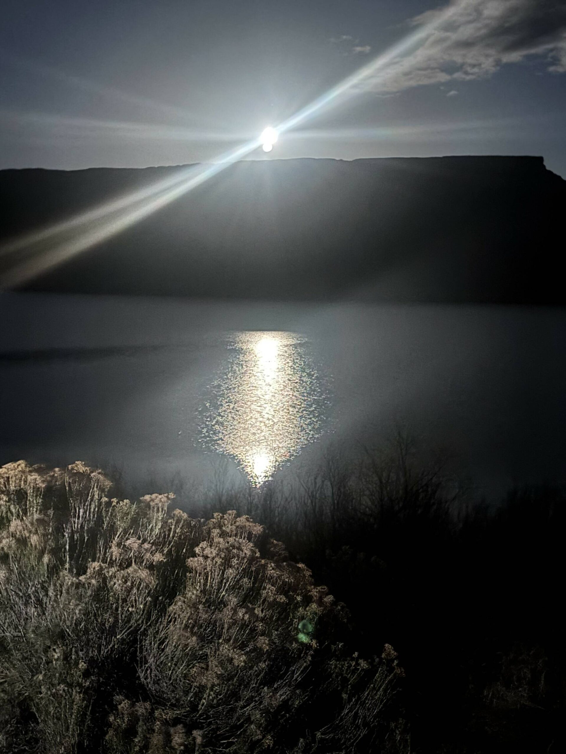
Photo by Kevin Hanson Washington’s high desert country provides some spectacular evenings, when the moon crests over the butte and shimmers on Banks Lake.