Fires at Mount Rainier, Bolt Creek shroud region in smoke
Published 2:20 pm Friday, September 9, 2022


Wildfires around Washington state have created smoky skies across Enumclaw and Buckley and highway closures near Mount Rainier, but no local cities or communities are threatened at this time.
Much of south King County and east Pierce County, including Enumclaw and Buckley, had “Unhealthy” air quality until Sunday, when air quality was upgraded to “Moderate”.
When the smoke is bad, you should limit your time outside, keep your windows closed and use the “recirculate” button on your car’s AC. Cloth masks like the kind used for COVID-19 aren’t very good at keeping smoke out, but a tight-fitting N95 or P100 respirator can reduce your exposure to smoke particles.
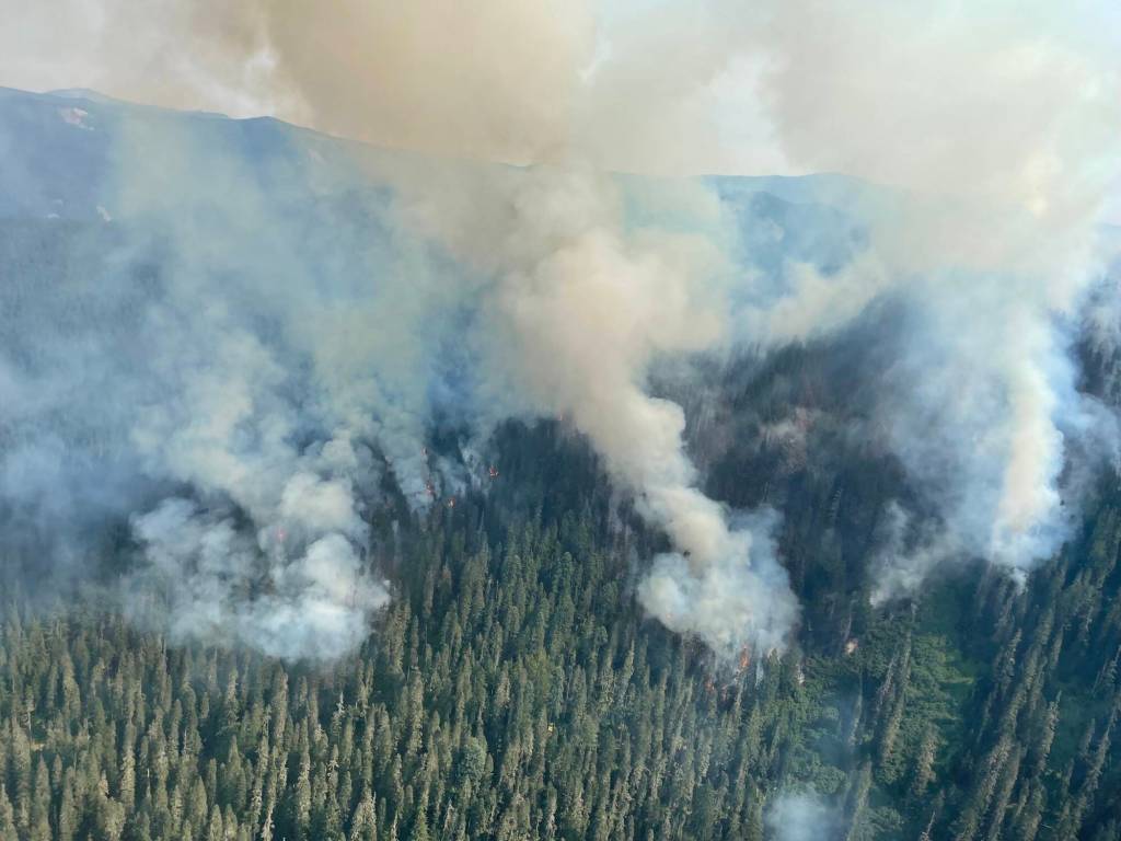
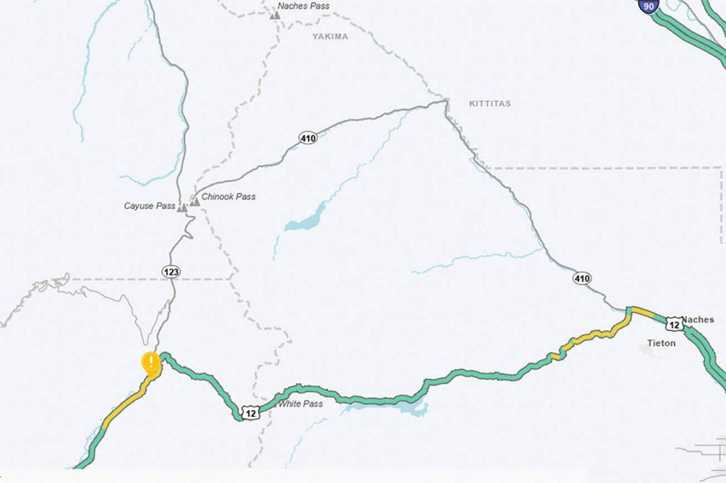
The Goat Rocks Fire, located east of Packwood, led state emergency crews to close both directions of US 12 between Skate Creek Road in Packwood and the top of White Pass, and the full length of SR 123 between SR 410 and US 12 over the weekend due to smoke. The roads had reopened by Sunday evening, but travelers should still be prepared for smoky conditions.
Additionally, a fire ban has been in effect at Mount Rainier National Park since Friday. The ban applies to all campfires and the ignition of wood, briquettes, or any fuel in fire pits, fire pans, and barbecue grills.
As of Monday morning, the fire had grown to 2,842 acres large, and had reportedly been starting by a lightning strike on Aug. 9. While fire crews knocked it down at one point in August, steep terrain prevented them from fully extinguishing it and the fire revived itself this month after several weeks of smoldering. Packwood was forced to evacuate on Friday.
Meanwhile, the Bolt Creek Fire, located between Index and Skykomish alongside U.S. 2, has grown to nearly 8,000 acres, threatening hundreds of homes and forcing several communities in the east county to evacuate. As of Monday, it is only 2% contained. U.S. 2 is expected to remain closed west of Stevens Pass for the foreseeable future.
To check on the status of these fires and more, visit: https://inciweb.nwcg.gov/incident/8415/.