Mount Rainier seeks input on SR 410 flooding and erosion risk reduction project | National Park Service
Published 11:30 am Wednesday, March 12, 2025
Editor’s note: The following is a press release from the National Park Service.
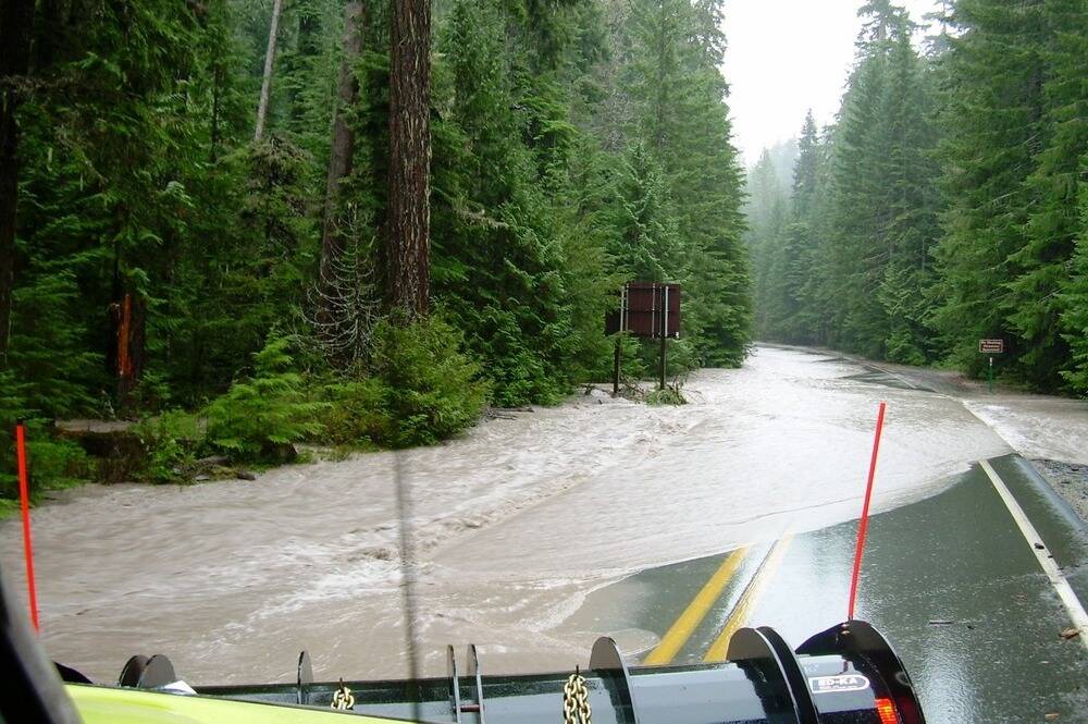
The National Park Service (NPS) and the Washington State Department of Transportation (WSDOT) are seeking public input on a proposed project that would reduce the risk of flooding and erosion to a segment of State Route 410 (SR 410) adjacent to the White River in Mount Rainier National Park.
WSDOT is proposing to build two log structures in the White River floodplain within the Mount Rainier wilderness adjacent to the road corridor to prevent possible flooding of the SR 410 road corridor.
Details of the project area and the proposed action are available on the project website at https://parkplanning.nps.gov/projectHome.cfm?projectId=123938. Public comments on the project will also be accepted on that site March 12 to April 11, 2025.
NPS and WSDOT have also scheduled a virtual public meeting for Wednesday, March 19, from 4:30 p.m. to 6 p.m. to provide information about the project and answer questions. Links to join the live meeting or watch a later recording will be posted to the project website.
“Providing sustainable public access to and through Mount Rainier National Park on this highway is a shared management goal for the National Park Service and the Washington State Department of Transportation,” said Park Superintendent Greg Dudgeon. “We highly encourage members of the community and park visitors to attend the public meeting and provide input on this proposed flooding and erosion risk project. Details of the project area and the proposed action are available on the project website and on the project StoryMap.”
State Route 410 serves as a gateway to Mount Rainier National Park’s east side, including access to the White River Campground, Sunrise, and popular trailheads. The highway is directly adjacent to and within the floodplain of the White River, which drains the Emmons Glacier. Several locations along SR 410 have been damaged by past flooding and are at increasing risk of future flooding and erosion.
The park anticipates preparing an environmental assessment to analyze impacts of the proposed flooding and risk reduction project. Public comments will help inform and support the park’s decision-making related to the project design and environmental impact analysis.
For more information about the park, please visit www.nps.gov/mora.