Stormy weather inflicts scattered outages across Plateau area, isolated Mt. Rainier closures
Published 2:40 pm Monday, November 15, 2021


Powerful wind and rain battering the Pacific Northwest caused several power outages across Western Washington last week, and the Plateau was no exception.
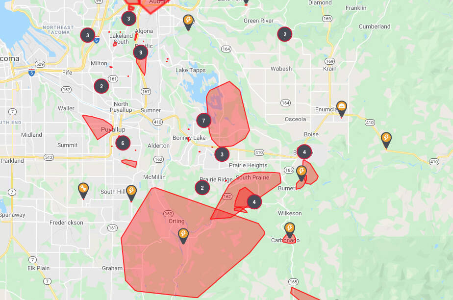
Puget Sound Energy had reported major outages affecting around 10,000 customers across the Plateau area by early morning Monday, Nov. 15, mostly limited to the Orting, Lake Tapps and South Prairie areas. Power had been fully restored to nearly all customers by that Wednesday afternoon.
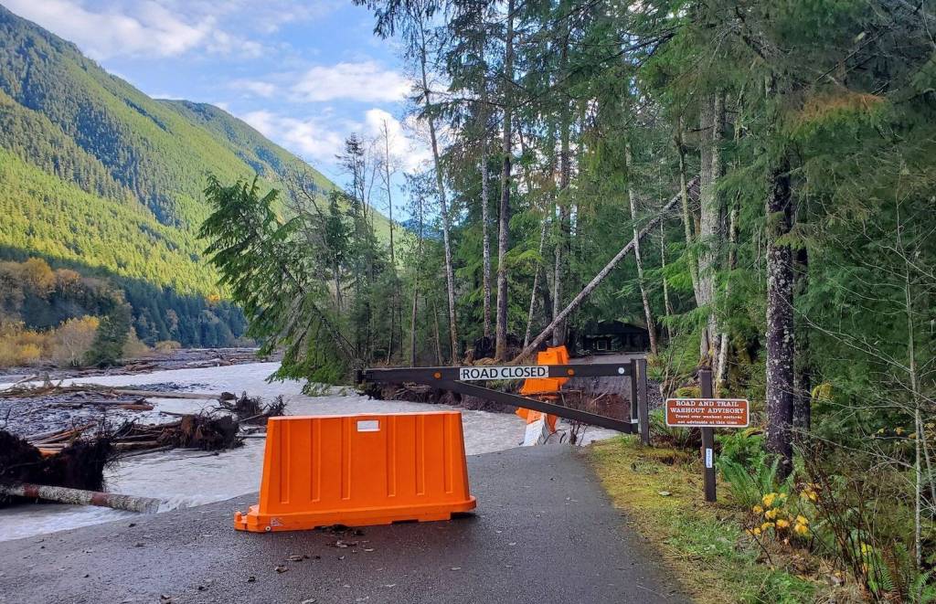
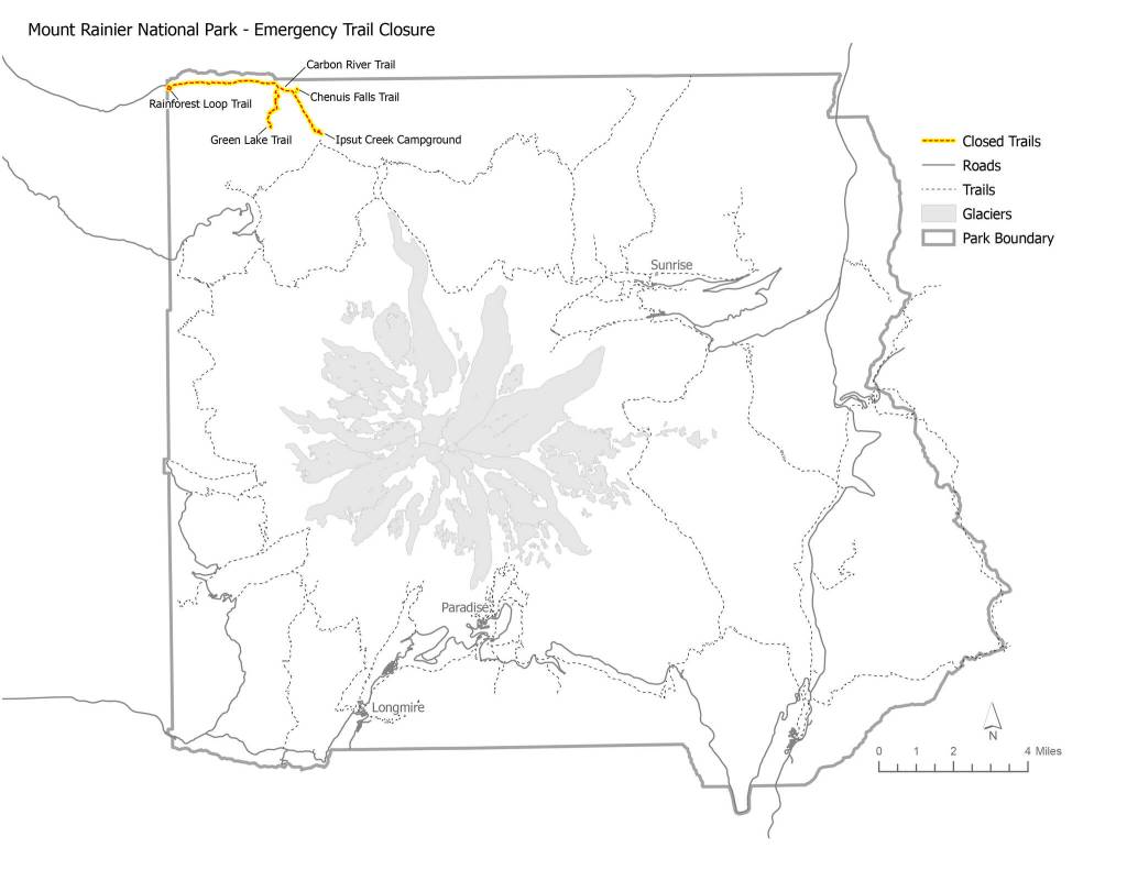
It also led Mount Rainier National Park to temporarily close parts of the Carbon River Area and the Grove of the Patriarchs to the public, according to announcements from the National Park Service (NPS). (See attached map.)
“Effective immediately and until further notice, the Carbon River Trail and all attached trailheads are closed to public entry,” the NPS said on Monday, Nov. 15. “The closure is due to erosion by the Carbon River, which has washed out the start of the Carbon River Road at the park boundary, and due to continued heavy precipitation, high river levels, and unstable trail conditions.”
As of Nov. 15, there was “no safe way” to access the Carbon River, Rainforest Loop, Green Lake or Chenuis Falls trails, nor the Ipsut Creek Campground, the NPS said. The Fairfax Forest Reserve Road had been partially washed out just west of the Carbon River Entrance since last winter, and the remainder of the road eroded away on Nov. 12, according to the NPS.
On Wednesday Nov. 17, the Park Service also closed access to the Grove of the Patriarchs in the southeast corner of Mount Rainier National Park, effective immediately. Recent flooding has damaged the suspension bridge providing the only safe method of access to the Grove, which is surrounded by swift, cold river water. The area will remain closed until the bridge can be repaired or replaced, according to the NPS.
Both locations remained closed to the public as of press deadlines Friday, Nov. 19.