Old Mine Trail: a short-but-steep climb provides a vivid reminder of region’s mining history
Published 10:30 am Friday, August 28, 2020


This is the second in a series of articles about local trails, campgrounds, parks, etc. – simply about places to enjoy the outdoors without traveling too far. Ideally, this will encourage folks to get outside, get some exercise and forget that we have been cooped up for months.
The focus will be on destinations in our own back yard and all will be of the “day trip” variety. Last week took us to the Melmont Ghost Town Trail and this week we’re headed into Mount Rainier National Park.
The target audience is the novice or, at least, not a seasoned veteran of the woods. Nothing here will involve summiting Mount Rainier or spending days trekking the Wonderland Trail.
If you have a suggestion for a hiking/camping adventure, pass it along. Just email khanson@cmg-northwest2.go-vip.net/courierherald. Offer a brief description from your personal experience.
OLD MINE TRAIL
The Old Mine Trail, which directly branches off the former Carbon River Road, is most-often described as “short but steep.” But that doesn’t truly paint an accurate picture.
It’s essentially like climbing stairs. The steps have been cut into a hillside that uses numerous switchbacks to allow for the quick elevation gain of about 350 feet.
The Old Mine Trail a pleasant diversion from main trail (former road) which is flat and not much of a challenge. After numerous washouts due to storms, it was decided in 2006 to convert the road to a trail.
From the trailhead, it’s 1.3 miles to the Old Mine Trail and it’s tough to miss. There a place to lock up bicycles and a sign noting the direction to the Washington Mining and Milling site.
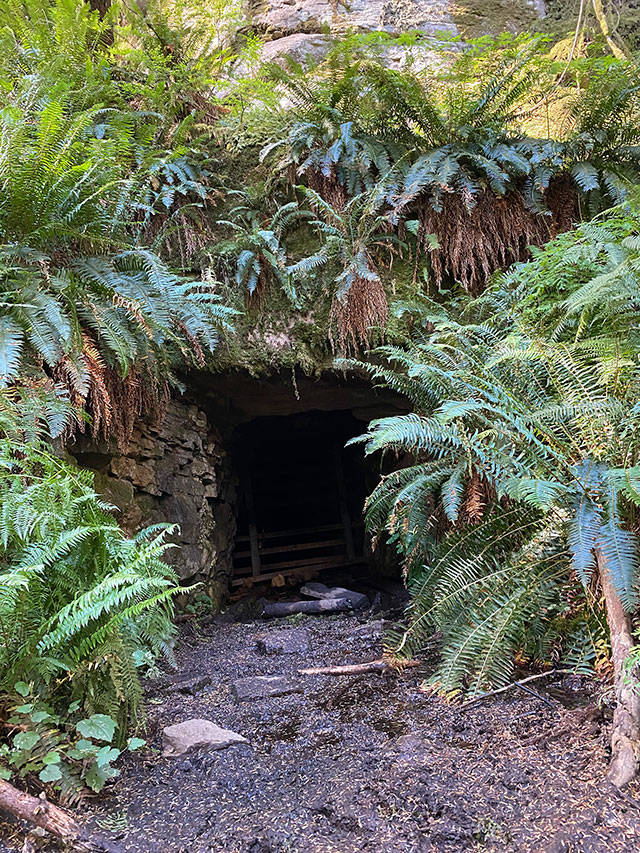
The Old Mine Trail takes visitors above the Carbon River, about one-third of a mile to a gaping hole in the hillside that is shrouded by ferns and shaded by towering trees. Visitors can take a few muddy steps into the mouth of the abandoned shaft, but there’s no added danger, as the mineshaft is gated to prohibit entrance.
Last weekend, a couple of trees blocked the trail to the top but a little hand-and-knees crawling allowed easy passage.
The mine is a link to the area’s history and leaves visitors wondering how intrepid miners navigated the steep slope in search of riches. A short stretch of railroad track shows where rail cars made their way up and down the hillside. (For the record, Washington Mining and Milling never did strike it rich, most likely searching for copper.)
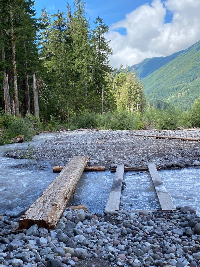
After reversing course and making the easy downhill hike, you’re back on what used to be Carbon River Road. Turn left and you return to the trailhead; turn right to continue the adventure. The wide trail continues another 3-plus miles, eventually leading to Ipsut Creek Campground.
There are opportunities for side trips along the way, most notably Green Lake and Ranger Falls. Continuing to Ipsut Creek Campground provides the added interest of crossing a small-but-quickly-moving stretch of the Carbon River. Planks have been provided to stroll across, along with a tree shaved flat; there are no handrails because, well, this is a hike.
A side trip to Chenuis Falls is not on the agenda these days, as the bridge over the Carbon has been washed away.
Getting there: head through Buckley, Wilkeson and Carbonado and cross the wonderful, one-lane Fairfax Bridge, all on state Route 165. Veer left onto the paved Carbon River Road and travel just shy of eight miles to the trailhead, passing the ranger station a couple of miles before the road ends and the walking begins.
The ranger station is a required stop if visitors do not have the appropriate pass. This hike is in Mount Rainier National Park, so a national park pass is required.